Grupo de investigación con observaciones lagrangianas

Enter


Grupo de investigación con observaciones lagrangianas


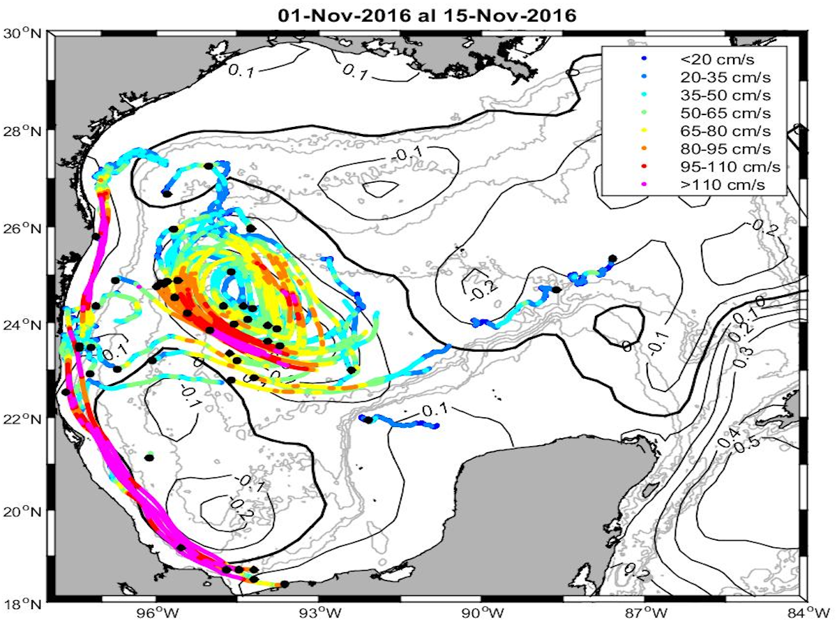
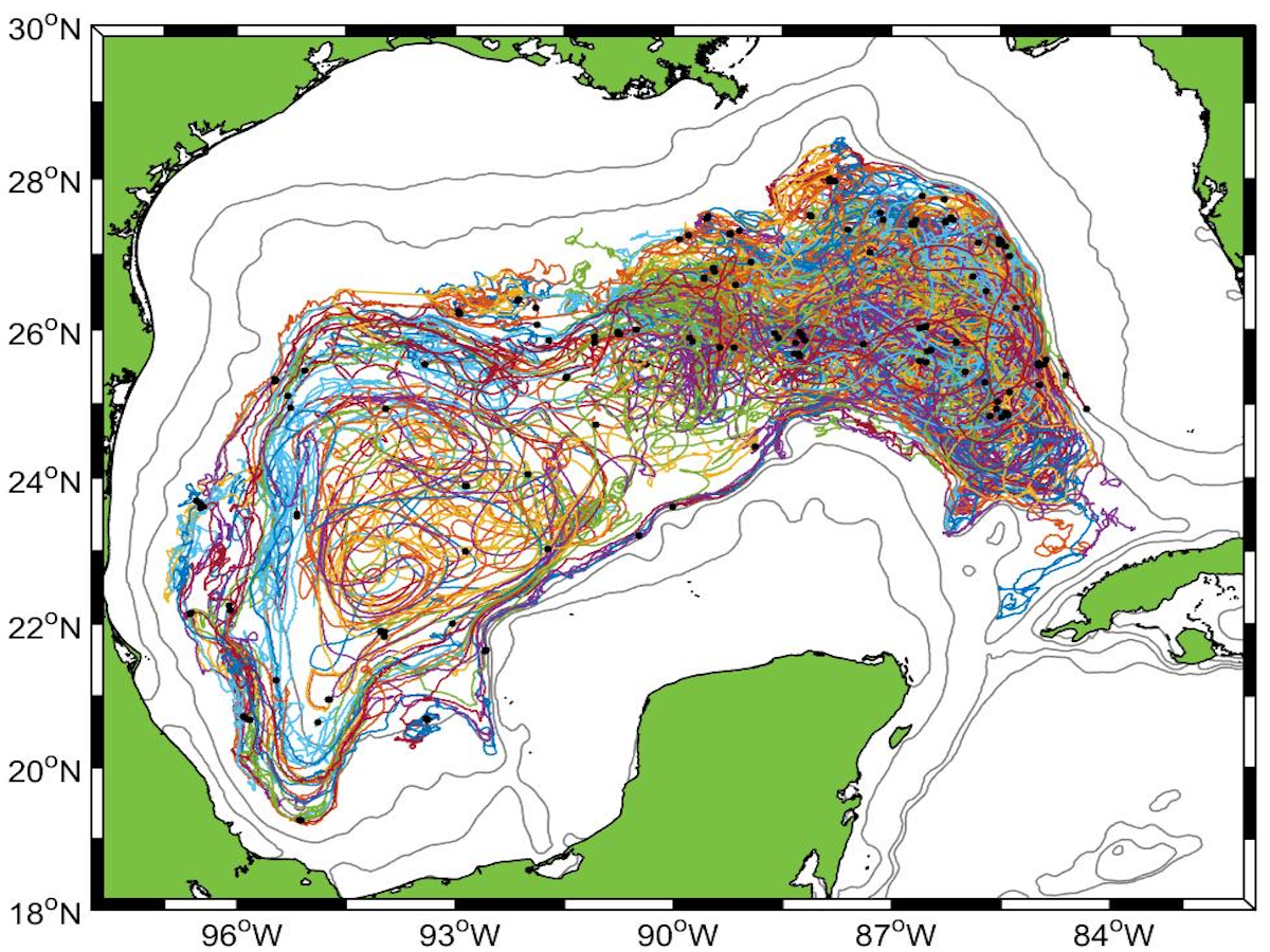
Somos un grupo que se especializa en el estudio de la circulación del océano a partir de observaciones con instrumentos a la deriva. Esto es, analizamos la evolución del flujo desde el punto de vista lagrangiano, que consiste en observar el movimiento de partículas individuales del fluido. Los aspectos de la circulación que nos interesan abarcan desde las pequeñas escalas como las involucradas en la dispersión y mezcla de trazadores, hasta las escalas más grandes como las que intervienen en los remolinos de mesoescala y la circulación general de una cuenca. Realizamos investigación interdisciplinaria en la que el punto de vista lagrangiano es útil, como lo es el transporte larvas en los estudios de dinámica poblacional de especies marinas.

Nos concentramos a estudiar diversos aspectos de la oceanografía del Golfo de México:

  • Los procesos físicos involucrados en el intercambio, dispersión y mezcla de trazadores.
  • La dinámica de los patrones de circulación de meso- y gran escala en la capa superficial y la capa profunda: el giro de Campeche, la corriente de frontera oeste en la capa superficial frente a Veracruz y Tamaulipas, los remolinos de la corriente del Lazo, la corriente de frontera de la capa profunda, y el acoplamiento entre las estructuras de la capa superficial y la profunda.
  • La conectividad biológica entre poblaciones de peces y otros invertebrados.
  • La generación de escenarios de derrames de petróleo.
  • Estimación de la vulnerabilidad biótica ante derrames de petróleo.

Team

Paula Perez Brunius Paula Pérez Brunius
Investigador Titular A
Departamento de Oceanografía Física
Centro de Investigación Científica y de Educación Superior de Ensenada
+52 (646) 175 0500 ext. 24044
http://usuario.cicese.mx/~brunius/
brunius@cicese.mx

Me gradué de Física en la Facultad de Ciencias de la Universidad Nacional Autónoma de México en 1996 y obtuve un doctorado en Oceanografía Física en la Universidad de Rhode Island, EUA, en 2002. Después de dos años trabajando en el Instituto Oceanográfico Woods Hole, regresé a México en 2005 para continuar un posdoctorado en el CICESE, y me incorporé como investigadora al Departamento de Oceanografía Física en 2007.
Paula Garcia Paula García Carrillo
Técnico especialista en Oceanografía Física.
Physical Oceanography Department
Centro de Investigación Científica y de Educación Superior de Ensenada
+52 (646) 175 0500 ext. 24115
pgarcia@cicese.mx

Paula empezó a trabajar en Oceanografía Física en CICESE desde 2007 y se encarga del procesado, control de calidad y análisis de los datos de los derivadores superficiales utilizados en los proyectos del grupo. Tiene una Maestría en Geología hecha en CICESE y trabajó primero durante siete años en el proyecto PEMEX y actualmente con el Proyecto de CIGOM.
Alejandro Domínguez Alejandro Domínguez Guadarrama
Técnico especialista en Oceanografía Física
Physical Oceanography Department
Centro de Investigación Científica y de Educación Superior de Ensenada
+52 (646) 175 0500 ext. 28725
adomingu@cicese.mx

Alejandro estudió Física en la Universidad Autónoma del Estado de México (2001), después hizo una maestría en Oceanografía Física en CICESE (2005). Trabajó 5 años como asistente de investigación el la Universidad Tecnológica de Eindhoven (2004-2009), en los Países Bajos y desde 2013 trabaja en CICESE como técnico especialista en Oceanografía Física.
Javier Rodríguez Javier Rodríguez Outerelo
Physical Oceanography Specialist
Physical Oceanography Department
Centro de Investigación Científica y de Educación Superior de Ensenada
+52 (646) 175 0500 ext. 24115
outerelo@cicese.mx

El trabajo de Javier se centra en el análisis de observaciones lagrangianas en el Golfo de México, especialmente en procesos de dispersión y conectividad. Por una parte, realiza cálculos estadísticos referentes a la dispersión de partículas, y la generación de imágenes que representan esta información para publicaciones y congresos. Además, también realiza cálculos que permiten inferir el grado de conexión (conectividad) entre ciertas regiones dentro del Golfo de México. Eventualmente también apoya en cruceros oceanográficos pertenecientes a los proyectos.
Argelia Ronquillo Argelia Ronquillo Méndez
Scientific Computing Specialist
Physical Oceanography Department
Centro de Investigación Científica y de Educación Superior de Ensenada
+52 (646) 175 0500 ext. 23118
aronquil@cicese.mx

Argelia tiene una maestría en Ciencias de la Computación. Su principal rol en el grupo es la preparación y configuración de cómputo científico, la manipulación de los datos que conlleva el almacenamiento, la distribución y la visualización. Parte de sus tareas también son la automatización de procesos, la administración de servidores, páginas web y cuentas de usuarios. Participa también en la preparación y lanzamiento de boyas a la deriva en los cruceros que se realizan en el Golfo de México.

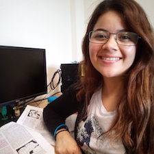
Julieta Gonzalez Joana Julieta Gónzalez Rejón
Estudiante de maestría
(2017 - 2020)
Tesis: "Intercambio de agua superficial entre la plataforma continental y la región profunda del golfo de México".
Physical Oceanography Department
Centro de Investigación Científica y de Educación Superior de Ensenada
joana@cicese.edu.mx

Información actual: Oceanóloga, con interés en circulación oceánica. Trabajo de investigación de maestría enfocado en caracterizar los intercambios de agua a través de la plataforma continental en el Golfo de México mediante observaciones lagrangianas y anclajes.
Georgina Rojo Georgina Rojo de Anda
Estudiante de maestría
(2017 - 2020)
Tesis: Caracterización del flujo a lo largo de la costa oeste del Golfo de México.
Physical Oceanography Department
Centro de Investigación Científica y de Educación Superior de Ensenada
grojo@cicese.edu.mx

Javier Rodríguez Javier Rodríguez Outerelo
Estudiante de maestría
(2012 - 2015)
Tesis: "Conectividad del Golfo de Campeche con el resto del Golfo de México a partir de datos lagrangianos reales y simulados".
Physical Oceanography Department
Centro de Investigación Científica y de Educación Superior de Ensenada
outerelo@cicese.mx

Información actual:
Técnico especialista en Oceanografía Física en el Consorcio de Investigación del Golfo de México.
Natali Cordero Nathalí Cordero Quirós
Estudiante de maestría
(2012 - 2015)
Tesis: "Variabilidad estacional de la circulación inducida por viento en el Golfo de Campeche
Physical Oceanography Department
Centro de Investigación Científica y de Educación Superior de Ensenada

Información actual:
Estudiante de Doctorado en UCSD-SIO
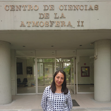
Alin Calva Miriam Alin Calva Chávez
Estudiante de maestría
(Septiembre 2011 - abril 2014)
Tesis: "Variación estacional y sinóptica de la trampa de surgencia en la Bahía de Todos Santos B. C."
Physical Oceanography Department
Centro de Investigación Científica y de Educación Superior de Ensenada

Información actual:
+52 (555) 6224800 ext. 44980
mcalva@atmosfera.unam.mx
Más información aquí

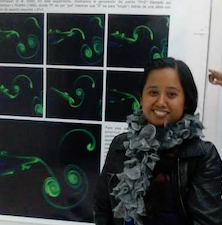
Erika Sandoval Erika Sandoval Hernández
Estudiante de maestría
(2009 - 2011)
Tesis: "Estudio del ciclón en el Golfo de Campeche con datos lagrangeanos y experimentos de laboratorio".
Physical Oceanography Department
Centro de Investigación Científica y de Educación Superior de Ensenada

Información actual:
Investigador por Retención CONACYT
Posgrado Biosistemática, Ecología y Manejo de Recursos Naturales y Agrícolas (BEMARENA)
Centro Universitario de la Costa
Universidad de Guadalajara.
erika.sandoval.hdz@gmail.com

Luz Erandi Luz Erandi Saldaña
Postdoctoral Researcher
(2017 - Present)
Physical Oceanography Department
Centro de Investigación Científica y de Educación Superior de Ensenada
+52 (646) 175 0500 ext. 28725
lsaldana@cicese.mx

Orens Pasqueron Orens Pasqueron de Fommervault
Postdoctoral Researcher
(2016 - 2017)
Marine Ecology Department
Oceanology Division
Centro de Investigación Científica y de Educación Superior de Ensenada

Información actual:
Doctor en Oceanografía
ALSEAMAR Alcen
Rousset, Francia
Erika Hernandez Erika Sandoval Hernández
Postdoctoral Researcher
(2015 - 2018)
Physical Oceanography Department
Centro de Investigación Científica y de Educación Superior de Ensenada

Erika trabajó en el estudio de estructuras de mesoescala con datos de boyas de deriva para analizar la circulación en el Golfo de Campeche con el fin de determinar la influencia de la topografía sobre el ciclón semi-permanente presente en la regió. También estudió el transporte horizontal del interior al exterior de los remolinos de la Corriente de Lazo con base a la salida de las boyas que fueron lanzadas en su interior.

Información actual:
Investigador por Retención CONACYT
Posgrado Biosistemática, Ecología y Manejo de Recursos Naturales y Agrícolas (BEMARENA)
Centro Universitario de la Costa
Universidad de Guadalajara.
erika.sandoval.hdz@gmail.com
Marc Piedeleu Marc Piedeleu
Postdoctoral Researcher
(2016 - 2017)
Physical Oceanography Department
Centro de Investigación Científica y de Educación Superior de Ensenada

Projects

CIGOM
Description:

Este es un megaproyecto del Consorcio de Investigación del Golfo de México (CIGoM). Nuestro grupo colabora en varios aspectos de este megaproyecto, pero nuestra mayor responsabilidad radica en la Línea de acción 5: Escenarios de derrames y en particular en el subproyecto Dispersión de partículas en superficie y a profundidad y conectividad biológica sobre el talud continental del Golfo de México occidental.

Responsible Researchers:
Goals:

El objetivo principal es caracterizar la dispersión a través y a lo largo del talud continental en la zona del noroeste del Golfo de México (polígono de Perdido), tanto en superficie como a diferentes profundidades. Para ello es necesario comprender el papel de los diversos factores ambientales que controlan y modulan la dispersión. Entre estos están los remolinos y frentes de mesoescala, la estratificación y el forzamiento del viento. La metodología usada es el lanzamiento de triadas de derivadores en superficie (1m) y en dos niveles de la columna de agua (300m y 1500m), durante cuatro experimentos en 2016 y 2017 (2 inviernos y 2 veranos). Con el uso de un sensor de mciroestructura en un glider, también se cuantificacrá la mezcla vertical.

El subproyecto también tiene una componente biogeoquímica y otra biológica. En la química se medirá la composición isotópica de la materia orgánica e inorgánica, con el fin de establecer las condiciones base, de manera que los isótopos de carbono puedan ser utilizados para distinguir los derrames de hidrocarburos a partir de las concentraciones de fondo naturales. La componente biológica consiste en evaluar la conectividad biológica en especies planctónicas representativas, para producir un modelo biofísico de sus patrones de dispersión.

BOEM
Responsible Reserachers:
Goals:

El objetivo de este estudio es aumentar nuestro conocimiento de la dinámica de la circulación profunda del Golfo de México a través del análisis de observaciones de derivadores subsuperficiales. Otro de los objetivos es mapear la circulación promedio y su variabilidad a 1500m, así como generar nuevo conocimiento sobre los procesos físicos involucrados en el transporte y dispersión de trazadores en aguas profundas. Se lanzaron un total de X boyas RAFOS que se rastrearon acústicamente a 1500 y 2500m de profundidad , así como 7 boyas perfiladoras APEX con sensores hidrográficos y bio-ópticos que también se rastrearon acústicamente a 1500m.

PEMEX
Responsible Researchers:
Goals:

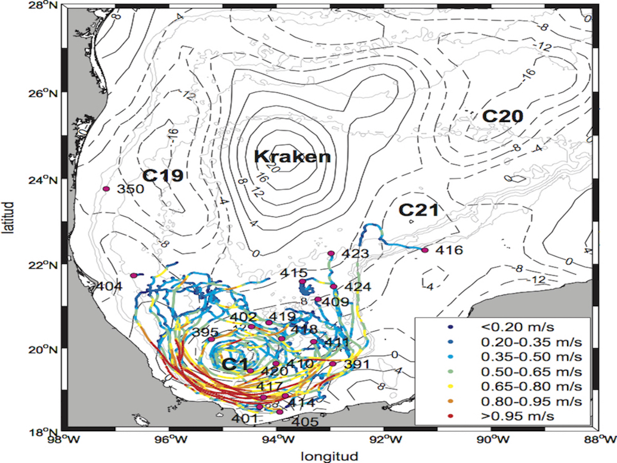
En este proyecto nos encargamos de la componente de boyas de deriva del proyecto, con el objetivo de estudiar los patrones circulación superficial promedio y su variabilidad en la bahía de Campeche. Para ello combinamos la información de boyas de deriva superficiales, datos de correntímetros anclados, e información satelital (altimetría, temperatura superficial, color).

Los objetivos particulares se centraron en:

  • El monitoreo de remolinos y chorros superficiales en la bahía de Campeche
  • Los procesos de intercambio de aguas de la bahía con el Golfo de México Norte
  • Los patrones de circulación promedio y su variación estacional
  • La estadística Lagrangiana para el análisis de la dispersión de partículas

Articles

Single-particle statistics in the southern Gulf of Mexico

Zavala Sansón, L., Sheinbaum, J., & Pérez-Brunius, P.

Geofísica Internacional, 57(2), 139–150. 2018

Hydrography of the Gulf of Mexico using Autonomous Floats.

Hamilton, P., R. Leben, A. Bower, H. Furey, and P. Pérez-Brunius

Journal of Physical Oceanography, 48(4), 773–794. https://doi.org/10.1175/JPO-D-17-0205.1, 2018.

Dominant Circulation Patterns of the Deep Gulf of Mexico.

Pérez-Brunius P., H. Furey, A. Bower, P. Hamilton, J. Candela, P. García-Carrillo, and R. Leben.

J. Phys. Oceanogr., 48, 511–529, https://doi.org/10.1175/JPO-D-17-0140.1, 2018

Temporal variability of chlorophyll distribution in the Gulf of Mexico: bio-optical data from profiling floats.

Pasqueron de Fommervault, O., Perez-Brunius, P., Damien, P., Camacho Ibar, V. F. and Sheinbaum, J.

Biogeosciences. 14: 5647-5662 p. doi:10.5194/bg-14-5647-2017 (ID: 22912). 2017

Lagrangian dynamical geography of the Gulf of Mexico.

Miron, P., Berón Vera Kuziora, F. J. A., Olascoaga Amuchastegui, M. J., Sheinbaum Pardo, J., Pérez Brunius, P. y Froyland, G.

Scientific Reports. 7((1)): 7021(1-12) p. https://doi.org/10.1038/s41598-017-07177-w (ID: 22517). 2017

Surface Relative Dispersion in the Southwestern Gulf of Mexico.

Zavala Sansón, L., Pérez Brunius, P. y Sheinbaum Pardo, J.

Journal of Physical Oceanography. 47(2): 387-403 p. https://doi.org/10.1175/JPO-D-16-0105.1 (ID: 21241). 2017.

Point source dispersion of surface drifters in the southern Gulf of Mexico.

Zavala Sansón, L., Pérez Brunius, P. y Sheinbaum Pardo, J.

Environmental Research Letters. 12(2): 024006 p. https://doi.org/10.1088/1748-9326/aa537c (ID: 21242). 2017

Rearing conditions and habitat use of white seabass (Atractoscion nobilis) in the northeastern Pacific based on otolith isotopic composition.

Romo Curiel, A. E., Herzka Llona, S. Z., Sepúlveda, C., Pérez Brunius, P. y Aalbers, S.

Estuarine, Coastal and Shelf Science. 170: 134-144 p. https://doi.org/10.1016/j.ecss.2016.01.016, (ID: 19708). 2016

Seasonal behavior of dissolved cadmium and Cd/PO4 ratio in Todos Santos Bay: A retention site of upwelled waters in the Baja California peninsula, Mexico.

Delgadillo-Hinojosa, F., Camacho-Ibar, V., Huerta-Diaz, M. A., Torres-Delgado, V., Pérez Brunius, P., Lares Reyes, M. L. C., Marinone Moschetto, S. G. L., Segovia, J. A., Peña-Manjarrez, J. L., García Mendoza, E. y Castro, R.

Marine Chemistry. 168: 37-48 p., https://doi.org/10.1016/j.marchem.2014.10.010, (ID: 17743). 2015.

Lipophilic toxins in cultivated mussels (Mytilus galloprovincialis) from Baja California, Mexico.

García Mendoza, E., Sánchez Bravo, Y. A., Turner, A., Blanco, J., O'Neil, A., Mancera Flores, J., Pérez Brunius, P., Rivas Camargo, D. A., Almazán Becerril, A. y Peña Manjarrez, J. L.

Toxicon. 90: 111-123 p., https://doi.org/10.1016/j.toxicon.2014.07.017, (ID: 17744). 2014.

Direct observations of the upper layer circulation in the Southern Gulf of Mexico.

Pérez-Brunius P., P. García-Carrillo, J. Dubranna, J. Sheinbaum y J. Candela.

Deep-Sea Research Part II: Topical Studies in Oceanography. 85, 82-94, https://doi.org/10.1016/j.dsr2.2012.07.020, (ID: 14889). 2013.

Circulation over the continental shelf of the western and southwestern Gulf of Mexico.

Dubranna, J., Pérez-Brunius P., López Mariscal J.M., y Candela Pérez, J.

Journal of Geophysical Research. 116(C08009). http://doi.org/10.1029/2011JC007007, (ID: 16265). 2011.

The role of season and salinity influencing barnacle distributions in two adjacent coastal mangrove lagoons.

Starczak, V., Pérez Brunius, P., Levine, H., Gyory, J. y Pineda, J.

Bulletin of Marine Science. 87(3): 275-299 p. doi:10.5343/bms.2010.1022 (ID: 12462). 2011.

Comparison of upwelling indices off Baja California derived from three different wind data sources.

Pérez Brunius, P., López Mariscal, J. M., Parés Sierra, A. F. y Pineda, J.

California Cooperative Oceanic Fisheries Investigations Reports. 48: 204-214 p. (ID: 11224). 2007.

Hydrographic conditions near the coast of northwestern Baja California:1997- 2004.

Pérez Brunius, P., López Mariscal, J. M. y Pineda, J.

Continental Shelf Research. 26: 885-901 p., https://doi.org/10.1016/j.csr.2006.01.017, (ID: 8521). 2006.

Absolute transports of mass and temperature for the North Atlantic Current-Subpolar Front System.

Pérez Brunius, P., Rossby, T. y Watts, R.

Journal of Physical Oceanography. 34(8): 1870-1883 p. https://doi.org/10.1175/1520-0485(2004)034%3C1870:ATOMAT%3E2.0.CO;2, (ID: 10489). 2004.

Transformation of the warm waters of the North Atlantic from a geostrophic streamfunction perspective.

Pérez Brunius, P., Rossby, T. y Watts, R.

Journal of Physical Oceanography. 34(10): 2238-2256 p., https://doi.org/10.1175/1520-0485(2004)034%3C2238:TOTWWO%3E2.0.CO;2 (ID: 10488). 2004.

A method for obtaining the mean transports of ocean currents by combining isopycnal float data with historical hydrography.

Pérez Brunius, P., Rossby, T. y Watts, R.

Journal of Atmospheric and Oceanic Technology. 21(2): 298-316 p., https://doi.org/10.1175/1520-0426(2004)021%3C0298:AMFOTM%3E2.0.CO;2 (ID: 10490). 2004.

Databases


Full description: The surface drifters are GPS-tracked floating buoys with one hour resolution records that record the velocity and temperature of surface ocean currents.The main objective of this Lagrangian measurement program is to characterize surface particle dispersion in the deep waters of the Perdido region, with the intention of understanding the physical processes involved in the transport and mixing of passive tracers, in order to provide a dataset to assess the accuracy of numerical model predictions and improve the parameterizations of submesoscale features in simulated particle trajectories obtained from ocean models in the deep water regions of the Gulf of Mexico.
Four experiments were performed in two years (2016-2017) and two seasons for both years (spring and fall), using three different type of drifters: Microstar (MIC), CODE (COD) and DORIS (DOR). These were launched in triplets in a triangular shape of ~100m sides, each triplet separated by ~50km from each other along three cross-shore transects over the continental slope.
The data are delivered in NetCDF format in a "Contiguous ragged array representation of time series", under NetCDF Climate and Forecast (CF) Metadata Conventions, and using Attribute Convention for Data Discovery version 1.3 and the CF Standard Name Table version 1.6.
The data include: experiment ID, drifter type (model), drifter ID, triplet ID, drifter name, number of observations for each trajectory, time, latitude, longitude, zonal and meridional velocity, current speed and direction, sea water temperature (°C), strain value for those drifters that include drogue (only MICROSTAR), and 6 quality control flags. Note that some drifter IDs are repeated (3, 29, 14, 25, 26, 36, 72 and 78). That was because these drifters were recovered and deployed again in following experiments. As part of the quality control process, all drifter trajectory data has been examined to identify instances where drifter had a bad GPS position (flag 1, 2 and 4), record gaps longer than 6 hours (flag 3), submerged value under the limit that indicate loss of drogue (flag 5) and bad sea water temperature data (flag 6).

Acknowledgment: The DWDE database is a product with author registration in Mexico. It can be licensed for non-commerical use, and it is prohibited to share it with third parties, as well as to profit or sell products derived from it. Under these criteria, the only additional condition is that the product resulting from the use of this data includes the acknowledgments: "The acquisition of the surface drifter data from the DWDE experiment has been financed by the CONACYT-SENER-Hydrocarbons Sector Fund, Mexico (project 201441), developed by the Gulf of Mexico Research Consortium (CIGoM). We recognize PEMEX for promoting to the Fund the specific demand on oil spills and the environment. Database description and download request found here http://doi.org/10.5281/zenodo.3979964."

How to cite:
Meunier, T., Pérez Brunius, P., Rodríguez Outerelo, J., García Carrillo, P., Ronquillo, A., Furey, H., et al. (2021). A Deep Water Dispersion Experiment in the Gulf of Mexico. Journal of Geophysical Research: Oceans, 126, e2021JC017375. https://doi.org/10.1029/2021JC017375


Request Data


Database description:
The RAFOS float is an acoustically-tracked passive drifter that tracks high resolution, deep ocean currents by recording position, temperature, and pressure at intervals ranging between 6 and 24 hours (Rossby et al., 1986).  The objective of the DWDE project was to measure the ocean circulation patterns in the western Gulf of Mexico in order to estimate the rate at which a passive tracer (e.g. pollutant, nutrients, etc.) would spread. The floats were ballasted to drift with the ocean currents at 300 dbar and 1500 dbar, simultaneously targeting the upper and lower layers of the ocean circulation. Float deployments were "stacked" where possible so that both 300 dbar and 1500 dbar floats were launched at the same locations, and deployed in pairs, triplets, or quadruplets for calculating the dispersion statistics. The planned mission lengths were either 300 days, 365 days, or 540 days and were programmed to record data every 8 hours. Some floats have shorter missions due to "sharkbite", or what is presumed to be the un-scheduled removal of a float's dropweight by a large fish. This causes immediate surfacing of the float, and the end of its underwater mission. Data report available at https://hdl.handle.net/1912/25273
The data are delivered in NetCDF format using Attribute Convention for Data Discovery version 1.3 and the CF Standard Name Table version 1.6. A text file describing the metadata is also included. The data include: time, temperature (°C), pressure (dbar), latitude, longitude, zonal velocity, meridional velocity, and a sound source interpolation flag.
For more information about database quality control and anomalies see documentation

Acknowledgment: The RAFOS database is a product with author registration in Mexico. It can be licensed for non-commerical use, and it is prohibited to share it with third parties, as well as to profit or sell products derived from it. Under these criteria, the only additional condition is that the product resulting from the use of this data includes the acknowledgments: "The acquisition of the surface drifter data from the DWDE experiment has been financed by the CONACYT-SENER-Hydrocarbons Sector Fund, Mexico (project 201441), developed by the Gulf of Mexico Research Consortium (CIGoM). We recognize PEMEX for promoting to the Fund the specific demand on oil spills and the environment. Database description and download request found here http://doi.org/10.5281/zenodo.4118564

Reference:

Ramsey, Andree L., Furey, Heather H., Bower, Amy S., Pérez-Brunius, Paula, García-Carrillo, Paula, "The Deep Water Dispersion Experiment: RAFOS float data report June 2016 - January 2019", 2019-12. Technical report. Woods Hole Oceanographic Institution. DOI:10.1575/1912/25273, https://hdl.handle.net/1912/25273

Furey, H., Ramsey, A., Bower, A., and Pérez-Brunius,P.(2019) Trajectories of acoustically tracked subsurface floats in the western Gulf of Mexico from the Deep Water Dispersion Experiment. Reg. INDAUTOR Mexico (03-2019-120510230900-01, 13-Diciembre-2019)


Request data


Database description:
A gridded product, called GulfFlow, is created by averaging all available data from the GulfDrifters dataset within quarter-degree spatial bins, and within overlapping monthlong temporal bins having a semimonthly spacing. The data set runs from August 16, 1992 to August 1, 2019, for a total of 648 overlapping time slices. Odd- numbered slices correspond to calendar months, while even-numbered slices run from halfway through one month to halfway through the following month. A higher spatial resolution version, GulfFlow-1/12° is created in the identical way but using 1/12th degree bins instead of quarter-degree bins. In addition to the average velocities within each 3D bin, the count of sources contributing to each bin is also distributed, as is the subgridscale velocity variance discussed below. The count variable is a four- dimensional array of integers, the fourth dimension of which has length 30. This variable gives the number of hourly observations from each source dataset contributing to each three-dimensional bin. Values 1-15 are the count of velocities from drifters from each of the 15 experiments that have not been flagged as having lost their drogues, while values 16-30 are for observation from drifters that have been flagged as having lost their drogue. Values above 15 are only populated for the GDP, HARGOS, LASER and some of the DWDE drifters, as a drogue presence flag is not always available. The data is distributed in two separate NetCDF files, one for each grid resolution. More information about this database available in this document

Acknowledgment: GulfFLow is a product for non-commercial academic use, and it is prohibited to share it with third parties, as well as to profit or sell products derived from it. Under these criteria, the only additional condition is that the product resulting from the use of this data includes the following acknowledgments: "The GulfFlow database (http://doi.org/10.5281/zenodo.3978793) is a product of the Gulf of Mexico Research Consortium (CIGoM) and was partially funded by the CONACYT-SENER-Hydrocarbons Sector Fund, Mexico, project 201441."

How to cite:
Lilly, J. M. and Pérez-Brunius, P.: A gridded surface current product for the Gulf of Mexico from consolidated drifter measurements.Earth Syst. Sci. Data, 13, 645-669. https://doi.org/10.5194/essd-13-645-2021, 2021.


Request Data


Database description:

The data includes eddy displacement signals for all ridges, as well as the time-varying ellipse parameters and estimated ellipse center location. The instantaneous frequency is included, as is the instantaneous bias estimate derived by Lilly and Olhede (2012).The data are organized as appended trajectory data that can be readily separated through the use of the "ids" field. The ridge length (L*) and ridge-averaged (ξ*) are also included, as is measure of statistical significance denoted by (ρ*). The dataset is available for download as a NetCDF file.

GOMED is a product for non-commercial academic use, and it is prohibited to share it with third parties, as well as to profit or sell products derived from it. Under these criteria, the only additional condition is that the product resulting from the use of this data includes the following acknowledgments: "The GOMED database (http://doi.org/10.5281/ zenodo.3978803) is a product of the Gulf of Mexico Research Consortium (CIGoM) and was partially funded by the CONACYT-SENER-Hydrocarbons Sector Fund, Mexico, project 201441.

How to Cite: Lilly, J. M. and Pérez-Brunius, P.: Extracting statistically significant eddy signals from large Lagrangian datasets using wavelet ridge analysis, with application to the Gulf of Mexico, Nonlin. Processes Geophys., 28, 181-212, http://doi.org/10.5194/npg-28-181-2021, 2021.

References:
Lilly, J. M. and Olhede, S. C.: Higher-order properties of analytic wavelets, IEEE T. Signal Proces., 57, 146-160, https://doi.org/10.1109/TSP.2008.2007607, 2009.
Lilly, J. M. and Olhede, S. C.: Analysis of modulated multivariate oscillations, IEEE T. Signal Proces., 60, 600-612. 2012.


Request Data